|
Anglesey Coastal Path |
Day 8 | Introduction | Day 10 |
In spite of the lumpy ground we had a comfortable night and slept well. The wind had calmed down a lot during the night and a couple of times when I briefly woke to turn over I noticed that instead of wind I could just hear a steady, distant droning sound – presumably the noise of the turbines at the Wylfa power station. The day started bright and early when I heard Mel moving around and heading off for her morning ablutions. On returning she said she had sent a text message to wish her sister a happy birthday and had got an instant reply so I took that as a sign she must be awake early too and phoned her for a chat ten minutes later. Whoops – she’d only answered the text to shut her phone up so she could go back to sleep! Oh well, she managed to sound pleased to hear from me anyway so I wished her many happy ones and after a brief natter left her in peace!

Wylfa power station sits just the other side of Wylfa Head from Cemaes Bay
We were soon packed and on our way – we were definitely getting better at it as the days rolled by! It was a bit of a dull morning to start with, not really cloudy but a faint mist seemed to soften the distant views and the sky and sea had a cool grey cast. We walked down the private road from the big empty house and across the short link directly on to the coast path. It was good walking weather but very blustery and quite heavy going at times, especially when the path turned or the wind itself swung round such that we had to walk head on into it.

Wylfa nuclear power station as seen from the thoughtfully provided viewing platform
Passing the power station was interesting. The path through the wood leading to to it and the land around its driveway were all extremely neat and tidy – they are obviously working hard to maintain a good image. There’s a flight of wide stone steps leading to a viewing area from inside the wood which allows people to stand and stare for a while. It’s a nice touch – there isn’t really much to see apart from the huge buildings but it’s nice to not have to strain to peer over a fence to find that out! I liked the bit where we walked under the cables that stretched high over the path from the massive terminals on the side of the building up to the first pylon. Overhead power lines often make a gentle ticking, fizzing sound on a damp day but the air positively crackled around this first cable span!
After the power station the route was a bit unclear and we ended up emerging from a field onto the wrong bit of a lane. A careful look at the map soon showed our mistake though and we easily picked up the next footpath a bit further along. We crossed a small inlet that had a barn or maybe a disused house (we couldn’t really tell from the back) set back from the bay a little and with lots of gunnera plants in its garden unfurling their stems and leaves in a vigorous show of new shiny green. A stream flowed from the centre of the garden in a shallow rocky gulley down to the sea that provided us with a perfect sheltered place to sit for our breakfast stop.

Cemlyn Bay's shingle causeway is a very noisy half mile!
Round the next headland was Cemlyn Bay with its wide curved shingle causeway. Most of the zillions of assorted pebbles were lovely and smooth and round so in the timeless way all fathers show off to their daughters I selected a few suitably flat ones to demonstrate my skill at skimming them across the surface of the water. I can only assume it was my heavy rucksack knocking me off balance but after three pathetic failures and one vaguely alright one my arm began to hurt so I stopped. Mel agreed it was probably just unfortunate circumstances and we moved on.
It seemed quite a way across to the other side – the deep shingle forcing a slow, steady, plodding pace by just absorbing any attempts to walk more quickly. There were signs requesting that we remained on the path as there were birds nesting in the enclosed pool area beyond – presumably the targets of the two guys with SLR’s on tripods and big camouflaged telephoto lenses at the far end. I think our loud crunching, clattering footsteps across the causeway may have disturbed their photography as they didn’t even look our way when we passed by just a few yards behind them. Or maybe they were just unfriendly.

A clever idea for closing gates but coupled with big bulky rucksacks they made some of the stiles pretty difficult to get through!
The path from there led uphill through a series of wide gently sloping fields and tracks. The guide suggested that on a bleak winter’s day the area can be reminiscent of Northumberland but on this grey, slightly misty spring morning it looked more like Father Ted’s Craggy Island to us! The wind was strong again on the top and a wooden five bar gate broken clean in two with one half lying on the track twenty yards away suggested it had probably been much stronger not long before. Many of the stiles have fairly recently been replaced with kissing gates with drilled rocks hanging on steel cords to act as closing weights. The rocks seemed to get bigger the higher we went, presumably to hold fast against the fierce winds – but we had to smile when, after struggling to get ourselves and our big packs through the last couple of hiker-resistant gates, we found one where the steel cord had snapped and its oversized boulder lay in the ditch alongside! I hope it’s repaired with a smaller rock rather than a thicker rope.

The rocky north west corner of the island. The Skerries (islands) are just visible on the horizon
The shore on this western end of the north coast is pretty rugged with hard, sharp, stony beaches and jagged rocks. It’s dramatically beautiful but hard to imagine lying on a towel and sunbathing there – but maybe on a still, hot summer’s day it’s different. You’d certainly struggle to build much of a sandcastle with a plastic bucket and spade!
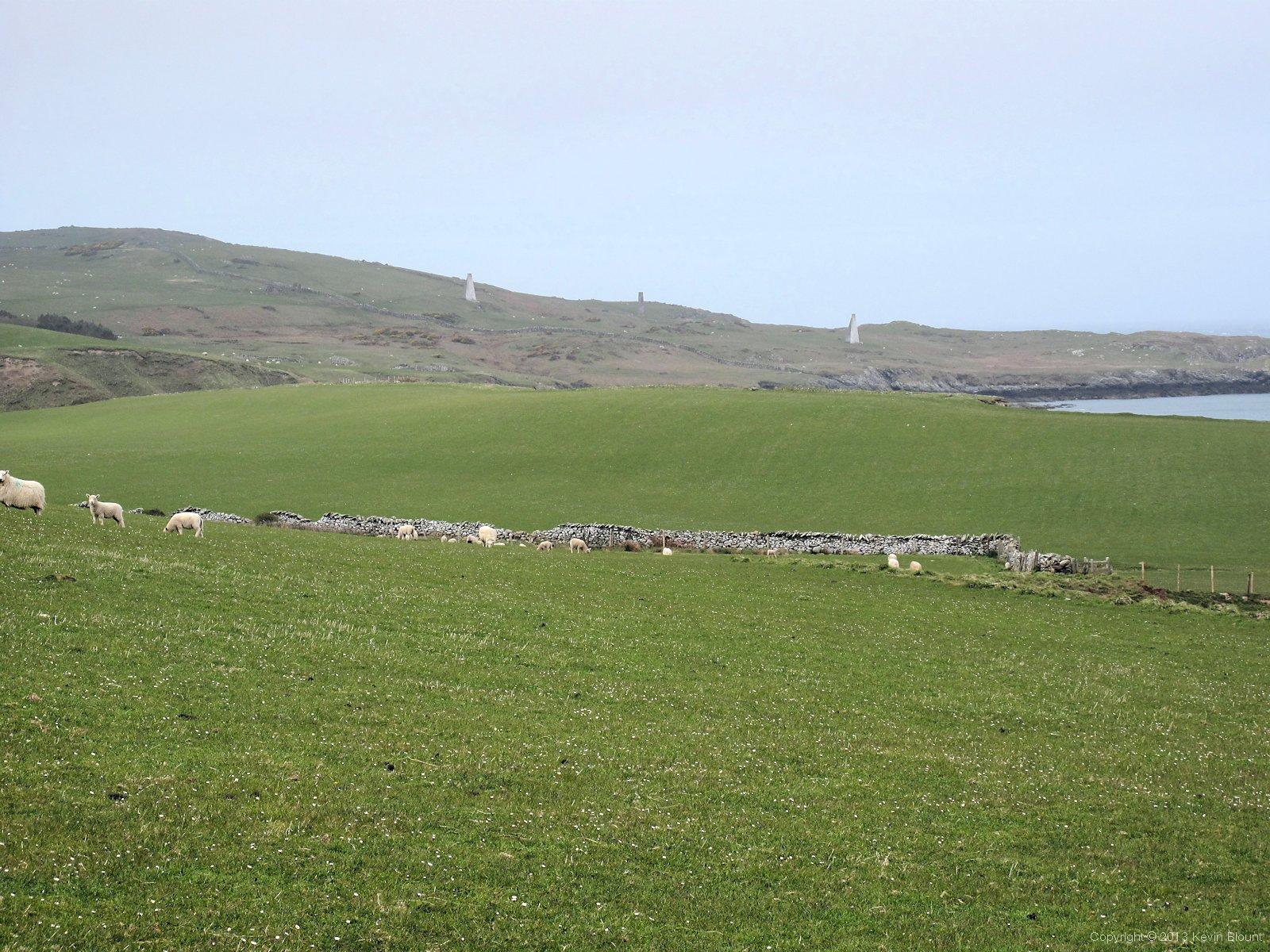
19th century navigation pillars still stand on the slopes of Carmel Head
There were two tall, white painted, tapered pillars on the hillside ahead, facing out to sea, one behind and above the other. They line up with a third smaller column on a rocky islet (West Mouse) just offshore and together form the ‘Three White Ladies’, built in the 1860s as a navigation aid to show approaching ships the position of a dangerous shallow reef.
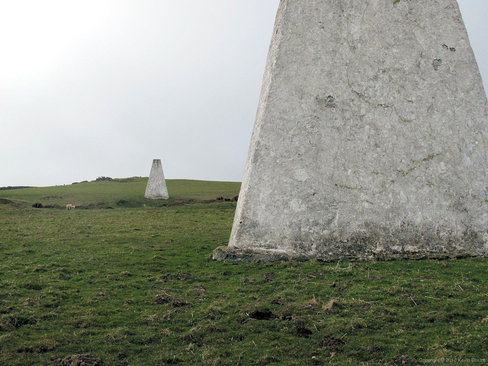
Up close to two of the Three White Ladies
Passing by the foot of the front obelisk it was surprising just how big they are. Previous generations obviously put a great deal of effort into trying different ways of improving safety. It had become clear to us from the number of wrecked remains we’d seen sticking out of the sand all around the coast that navigation must always have been a huge problem close to the island.
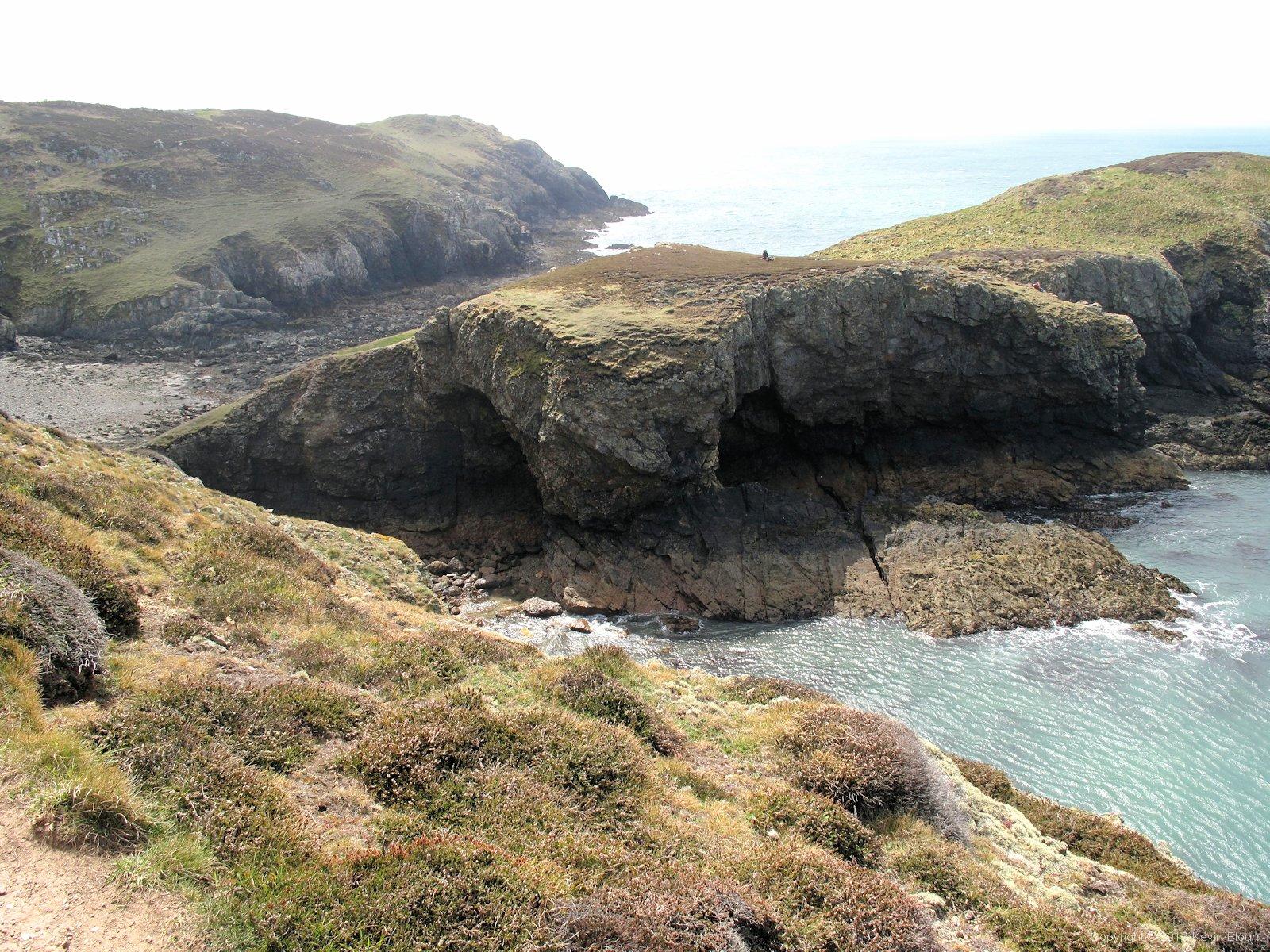
Ynys y Fydlyn - a spectacular promontory with sea caves and an arch
Once round the northwest corner and heading south we sat and ate our lunch overlooking a small bay and watched the weather beginning to brighten up. In a very short time the sea became a dazzling shade of turquoise reflecting the now clear blue sky and the still very strong wind was whipping up white foam flecks on top of all the waves. It was turning into a proper early summers day and we weren’t surprised to find quite a few people around when we descended to the impressive sea caves and arch of Ynys y Fydlyn. It’s only half a mile from a car park and is an ideal place for a Sunday picnic so there were non-walkers (normal people!) there too.
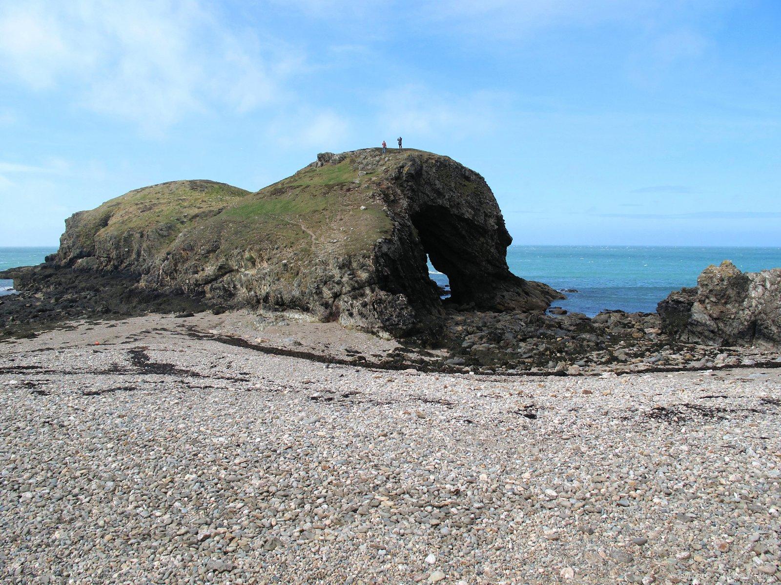
Ynys y Fydlyn is a spectacular example of coastal erosion
We passed through without stopping, nice as it would have been to explore we needed to keep going as we were hoping to actually visit a beach properly for the first time once we’d reached our site and pitched the tents. Back on the higher paths again we saw several white yachts had appeared out at sea, further enhancing the idyllic scene. The sun was beating down on us now, really quite hot as we marched along the cliff top path.
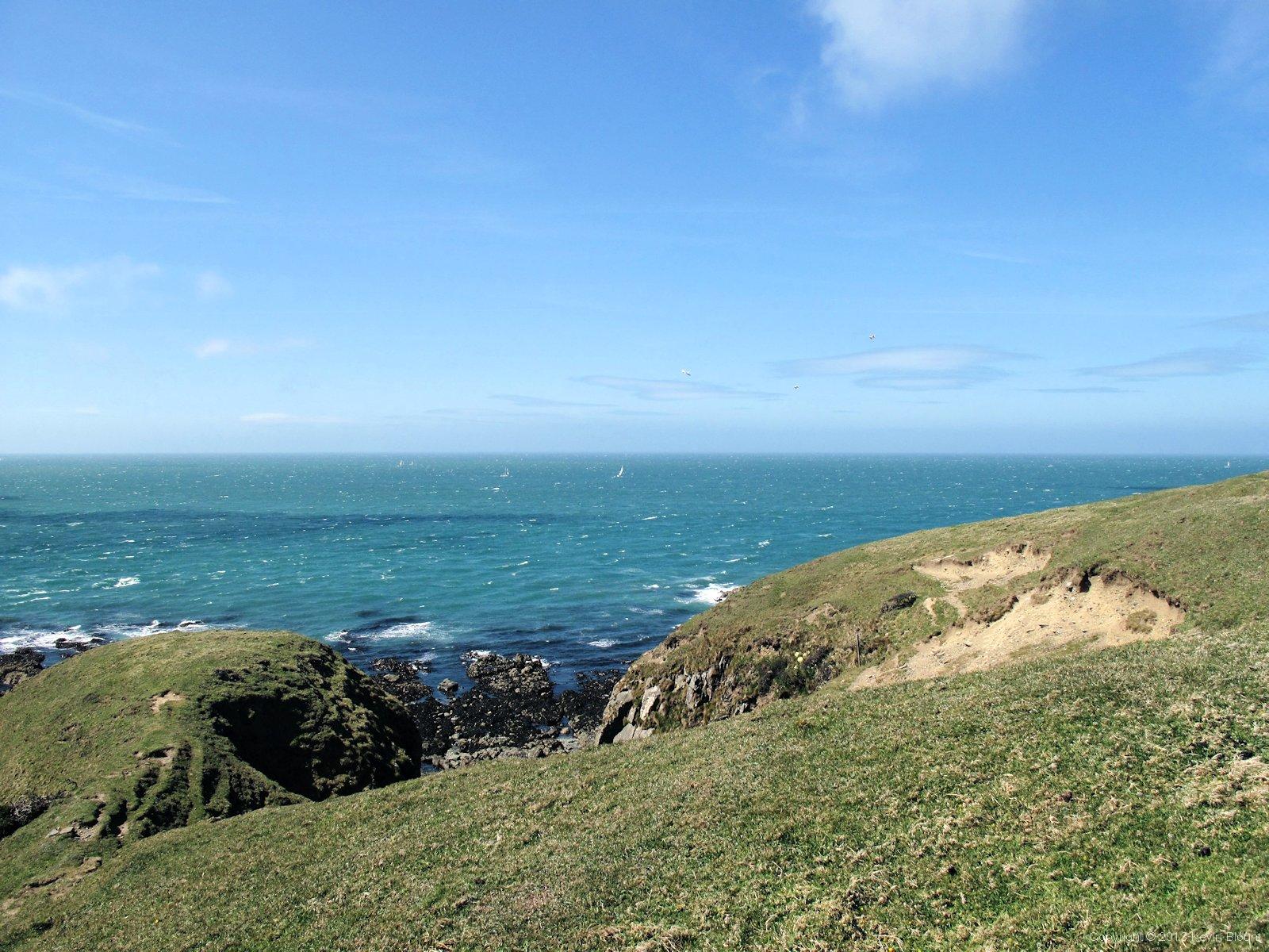
Blue sea, blue sky, sunshine, yachts, gulls and cliffs. Perfect.
Well ok, I say marched but to be honest our feet were getting pretty sore by this stage of the walk – mine more so than Mel’s. After wrecking our previous boots on the soggy Pennine Way the year before we’d both bought new boots and I don’t think we’d really put in enough miles yet either to bed the boots in or toughen up our feet again. A lot of the paths had been tarmac or gravel or just hard, dry earth and rock on this walk and it was taking its toll! The last stretch of the day’s walk seemed to take ages but we got through it, helped a bit by an ice cream and cold drink from the Church Bay tearooms, and we finally descended from the tops and turned – still on the coast path – into the first of two adjacent campsites.

Church Bay, the northernmost of a long series of sandy beaches
Both sites were pretty much like all such holiday sites – big, noisy and full of families with kids of all ages. The site we were on was even less backpacker friendly than we’d expected though; with no smaller, sheltered pitches available we had to pay for a standard single pitch and try to find a slightly less windy spot – the site owners/wardens suggested pitching near to the facilities block. Unfortunately we later discovered this area had already been adopted as an impromptu football pitch by a dozen youngsters although they did move the goalpost jumpers a bit on the second asking so our tents were less in the direct firing line! It also (inevitably in hindsight) turned in to the teen meeting place for the evening so we then had a couple of hours of overheard teenage chat that we could have done without. Actually Mel said she drowned it all out with her iPod but I was certainly grateful when the parents rounded them all up for the 10pm curfew and peace finally descended! I must make it clear I’m not blaming the kids for any of this – they were just being kids on holiday exactly as they should have been, but I think the site would do well to set aside a quiet corner for backpackers if the coastal path gets as popular as it deserves to be. There is no real alternative at the moment apart from the adjacent and apparently very similar site, but I really wouldn’t want to stay there again unless something changes.
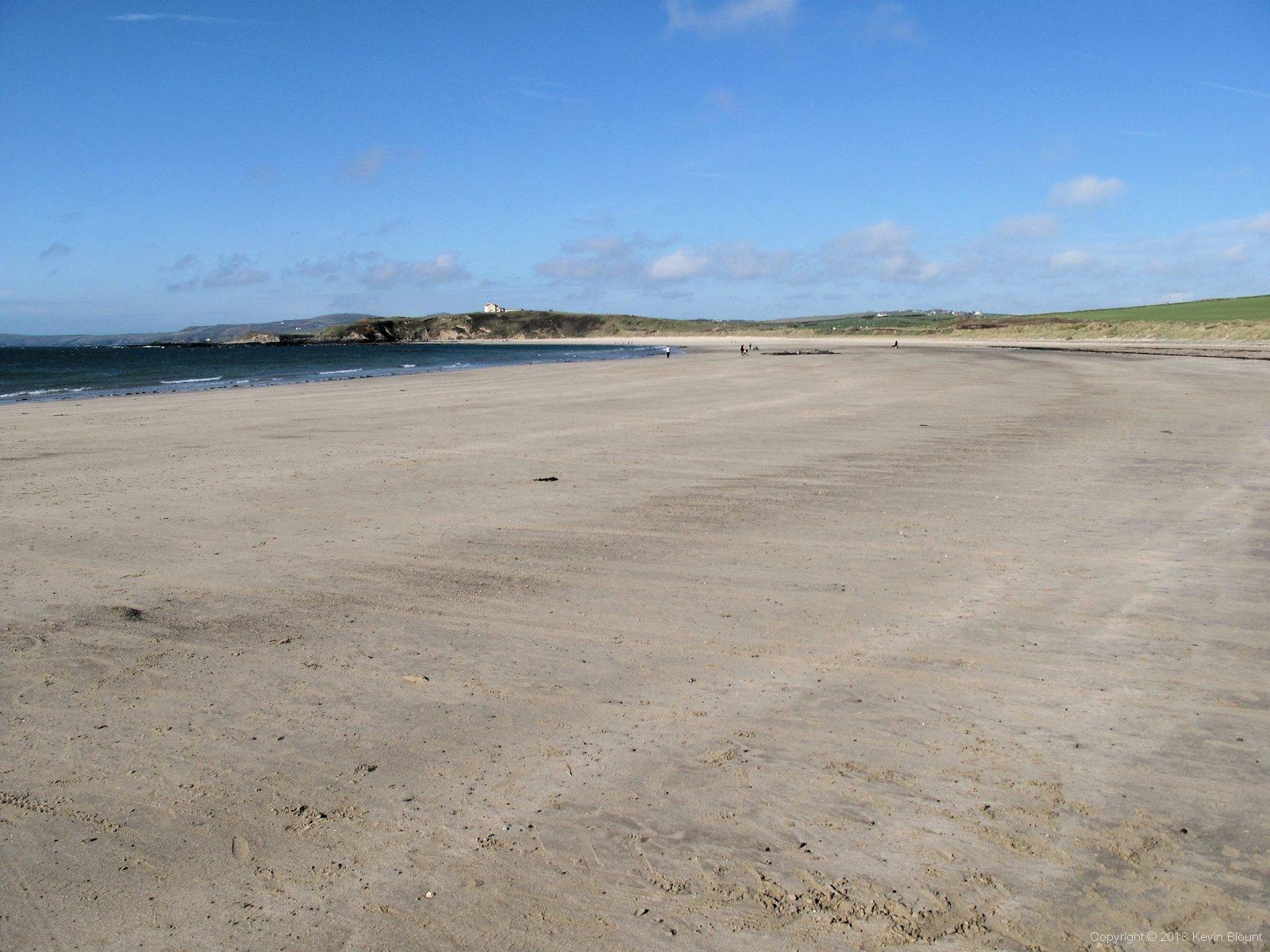
Porth Tywyn-Mawr, the wide sandy bay adjacent to the campsite
The one good thing about these sites of course is the whole reason why they became so popular in the first place – they are right next to a big, flat, sandy beach. We took advantage of this just after we’d pitched the tents and went for a brief paddle in the sea – the first and only one of the whole trip! It wasn’t particularly supposed to be brief but the water was absolutely freezing and instead of soothing our sore feet as we’d hoped it actually made them ache even more after a few minutes!
Day 8 | Introduction | Day 10